Ratings & Reviews performance provides an overview of what users think of your app. Here are the key metrics to help you identify how your app is rated by users and how successful is your review management strategy.
User reviews affect conversion to installs and app rating. Featured and helpful reviews are the first to be noticed by users and in case of no response can affect download rate.
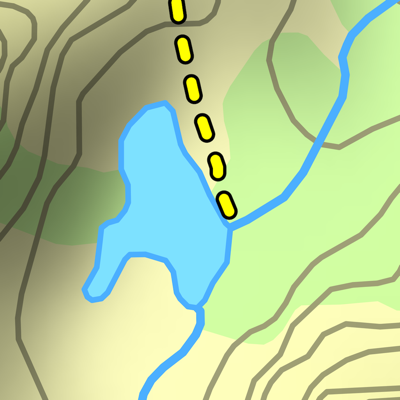
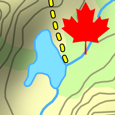
Download and view topographic maps covering the United States. Topographic maps are useful for recreational activities such as hiking, canoeing, camping, fishing, mountain biking, geocaching, and exploring. MAPS Choose from 2 map sources: USGS standard topographic or USGS hybrid topographic. OFFLINE Download maps for areas of interest to view them later when you don't have Internet access or you don't want to use cell data. TRACKING Use location tracking to show where you are on the map, your elevation, and the accuracy of the GPS signal. FLAGS Flags are included with map downloads. Add flags (waypoints) to the map to mark your current location or other locations. Import flags from other sources using GPX files and geocache LOC files. Share flags with others using email or AirDrop. Organize your flag types by color, for example, geocaches, trailheads, and summits. TRAILS Trails are included with map downloads. Import trails (tracks) using GPX files you find on the Internet or from your personal GPS track collection. Share trails with others using email or AirDrop. Organize your trail types by color, for example, mountain bike trails, hiking trails, and OHV trails. TRAIL RECORDING Record your own trails to show where you've been on the map, follow them later, and share with others. ELEVATION PROFILE Recorded trails include an elevation profile (distance/elevation chart). NAVIGATION Navigate to a flag by following the direction arrow that uses your compass heading. Useful for geocaching. MEASURE Measure the distance between points on the map. Note: Continued use of GPS running in the background can dramatically decrease battery life.