Ratings & Reviews performance provides an overview of what users think of your app. Here are the key metrics to help you identify how your app is rated by users and how successful is your review management strategy.
User reviews affect conversion to installs and app rating. Featured and helpful reviews are the first to be noticed by users and in case of no response can affect download rate.
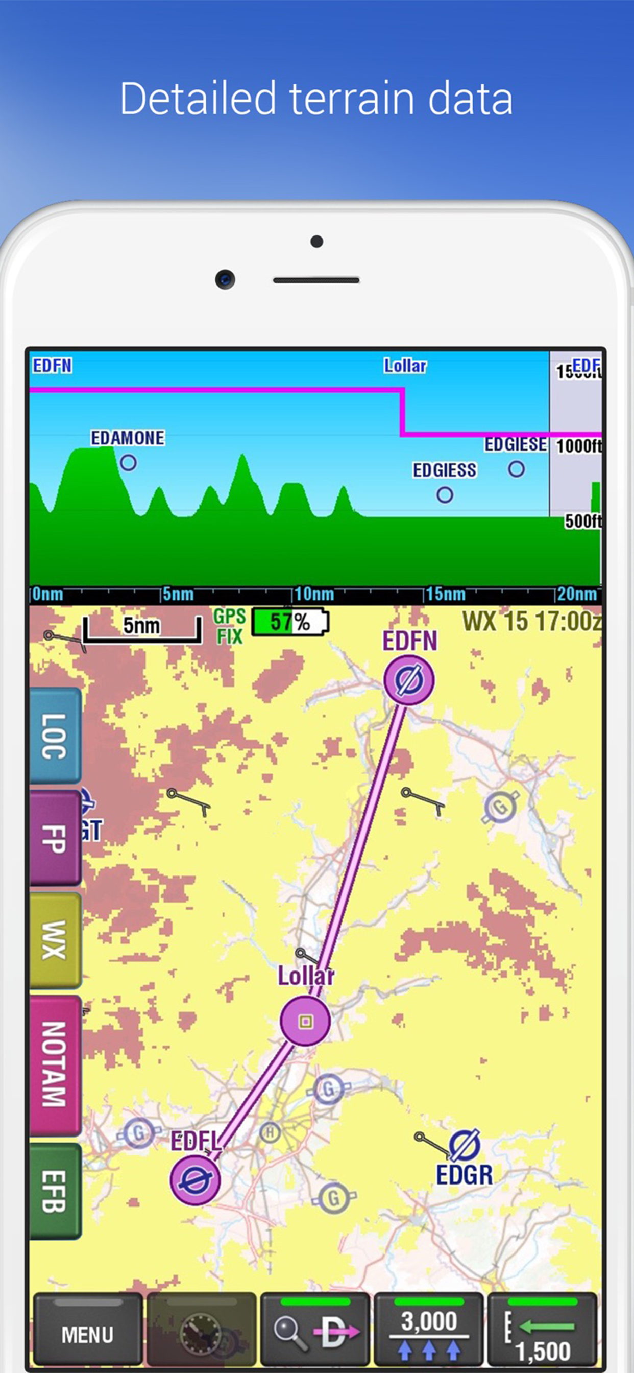
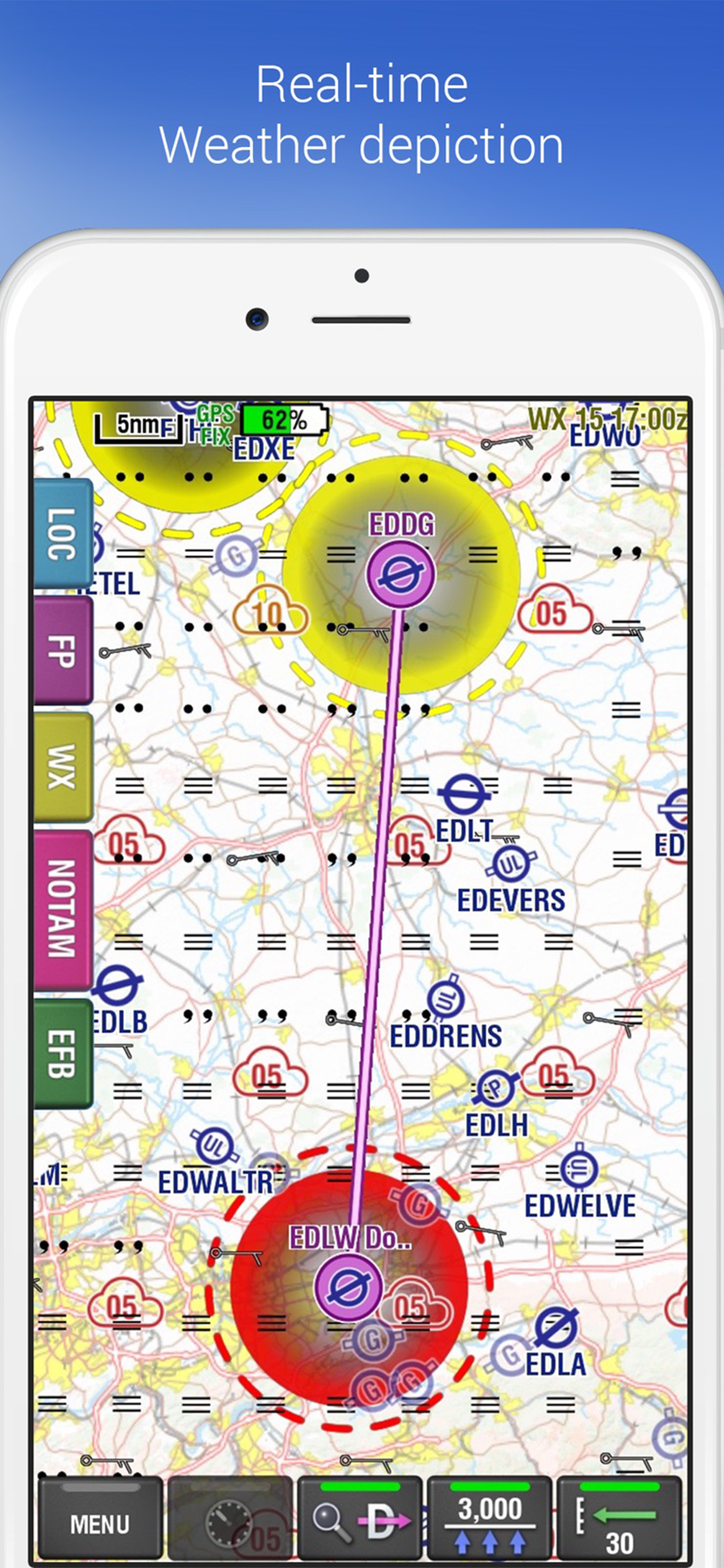
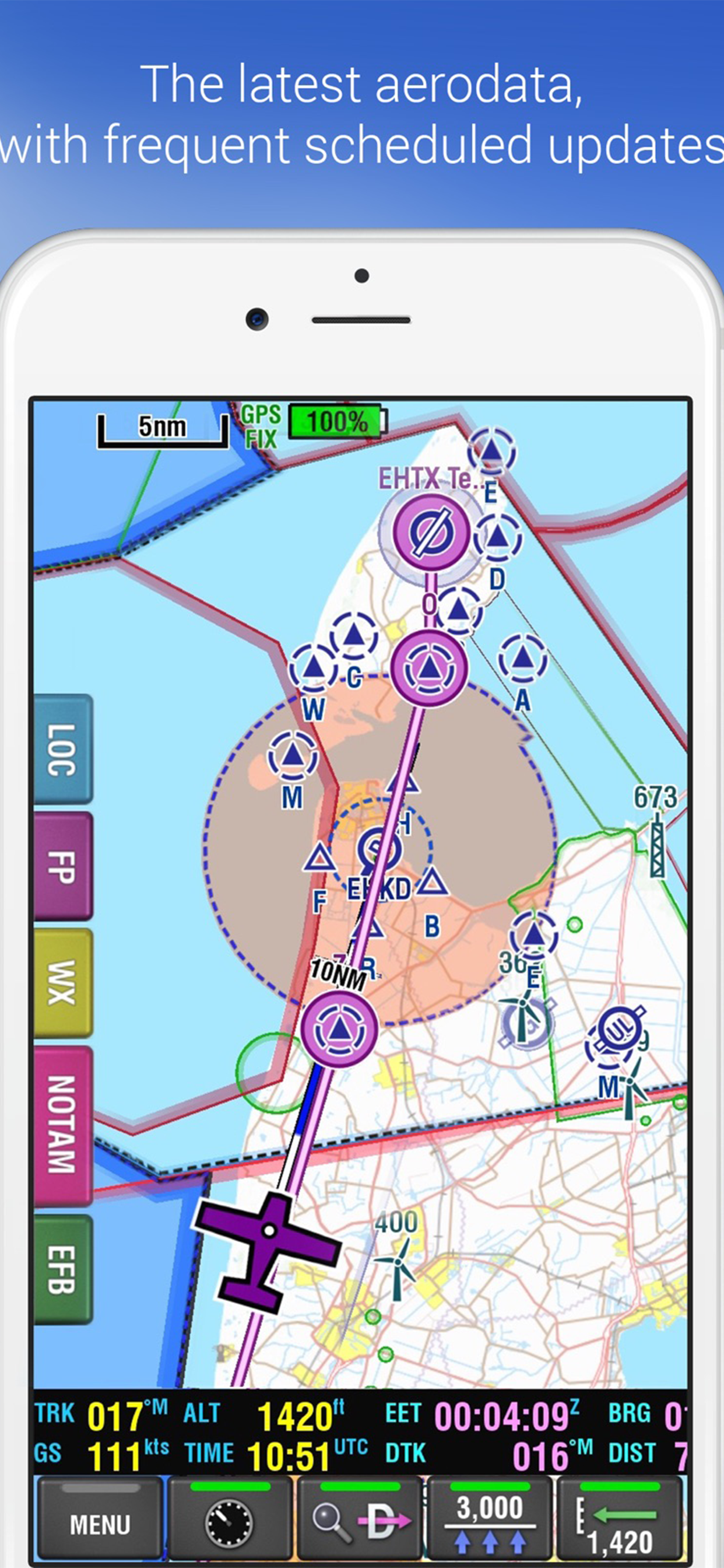
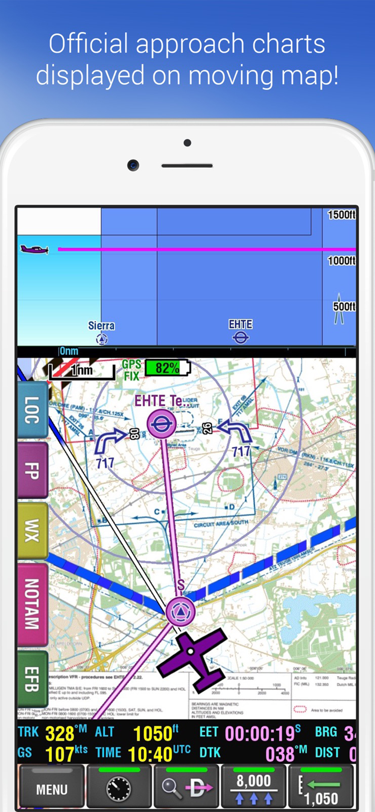
IMPORTANT: EasyVFR is NOT free. It requires an in-app subscription to function. The subscription provides updated AeroData for Europe, USA, Canada & Australia / New Zealand, published in line with the 28 day AIRAC cycle. It includes a continuous feed of EuroControl NOTAMs, and weather data from official sources in the supported regions and from our contracted professionals. EasyVFR aeronautical and weather data are included with an existing PocketFMS FFM license, or by a yearly subscription obtained as an in-app purchase after the app is installed: - Australia / New Zealand: AUD 84.99 - Canada: CAD 79.99 - USA : US$ 79.99 - Europe: Euro 69.99 • Your payment will be charged to your iTunes account at confirmation of purchase. • Your subscription is automatically renewed unless auto-renew is turned off at least 24 hours before the end of the current period. • Your account will be charged for renewal within 24 hours prior to the end of the current period. • Subscriptions may be managed by you and auto-renewal may be turned off via your Subscription Settings in iTunes. • No cancellation of the current subscription is allowed during active subscription period. Our terms of use can be found at http://www.pocketfms.com/0-eula.asp Our privacy policy can be found at http://www.pocketfms.com/0-PrivPol.asp EasyVFR is an aviation Moving Map which can be used for flight planning, GPS navigation and post-flight analysis on iOS devices (minimum iPhone 6 and/or iPad Air). With EasyVFR you can take your iPhone and iPad with you in the cockpit, plan your flight, and follow your route on a moving map, always confident of your position and the airspace and airports around you. PocketFMS has been providing flight planning and moving map systems since 2003. PocketFMS AeroData is professionally maintained to the highest standards, including AIP updates, for Australia/New Zealand, Canada, Europe & the USA. The AeroData is used in a number of leading panel mounted avionics. Currently the following is implemented: • Unique PDF TripKit. • Unique 3D View (Synthetic Vision) for Europe, Australia / New Zealand, Canada (up to 60°N) and the USA. • Terrain shading relative to aircraft altitude in both 2D and 3D view. • Full PocketFMS AeroData support including many non-AIP airports, VFR reporting points, obstacles, navaids, places. • Efficient flight planning; the easiest and fastest way to create multi-leg flight plans starts with just a tap & hold on a location on the map. • Printing of flight plan briefings (NavLog, Weather, NOTAMS & Airspaces) using the unique PFMSEasyPrint system. • Quick and easy Direct To. • Integrated meteo: the renowned Weather Information System provides graphical METAR & TAF depiction, and European Advanced WX cloud base forecast, W/V at different altitudes and SigWX like rain, fog, thunder. • Graphical European NOTAM depiction. • Beautifully clear & detailed PocketFMS base maps, or official charts for selected countries. • Practice as if you are flying, while safely on the ground, by connecting your device to the free PocketFMS Simulator. • EFB Documents System with: • Europe: All European Approach Plates from AIPs, Pooleys and DFS Anflugkarten, • Australia: ERSA & DAP Charts, • New Zealand: AIP Aerodrome Charts, • Canada: COPA's "Places to Fly". • Vertical Profile View for Airspaces, Terrain and Obstacles, Planning and Flying. • GPX flight plan import & export.