Ratings & Reviews performance provides an overview of what users think of your app. Here are the key metrics to help you identify how your app is rated by users and how successful is your review management strategy.
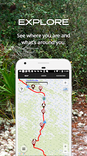
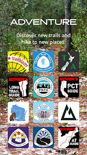
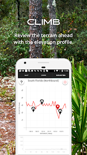
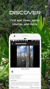
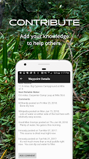
Please download "FarOut" (formerly Guthook Guides) to access the Florida Trail guide. Existing customers may transfer their purchases to the FarOut app. Information in this app is based on “The Florida Trail Guide” by Sandra Friend and John Keatley. The Florida Trail Guide is a detailed, map-based smartphone guide for your hike on the Florida Trail. It lists important hiker waypoints on the FT such as water sources, shelters, tenting sites, road crossings, resupply locations, and may others. The free demo covers the 42.3-mile Blackwater route from the Florida-Alabama border to Harold. In-app purchases include guides for: - South Florida - Ocean to Lake Trail - Central Florida - Central Florida West - Ocala Northeast - Suwannee & Big Bend - Eastern Panhandle - Western Panhandle - Blackwater Key features: - No mobile or internet connection is required after initial setup -- works in Airplane Mode - Detailed maps with your GPS location - Elevation profile view - Custom route creator - Multiple offline map choices - Real-time comments from other hikers - Send your current location to friends or family via text message or email The guidebook lists every waypoint in order by distance along the trail and how far away you are from each waypoint. The guidebook also includes a detailed town guide for major resupply points, towns, and services along the Florida Trail. Waypoint details include: - Mileage point and elevation - Photographs - Distance to the next water source and tent site - Comments section where you may post comments and read other hikers’ comments Types of waypoints: - Water sources (including the reliability of each water source) - Detailed resupply and town information: - post offices and other package services - restaurants - grocery stores and convenience stores - gear shops and hardware stores - laundromats - lodging, public showers, public restrooms - public libraries - Tenting sites/camping sites - Trail junctions - Parking areas along the trail - Picnic areas, campgrounds, ranger stations - Roads, railroad tracks, power lines, fences, gates - Natural landmarks (e.g. mountain passes) - Privies/restrooms - Views