Ratings & Reviews performance provides an overview of what users think of your app. Here are the key metrics to help you identify how your app is rated by users and how successful is your review management strategy.
User reviews affect conversion to installs and app rating. Featured and helpful reviews are the first to be noticed by users and in case of no response can affect download rate.
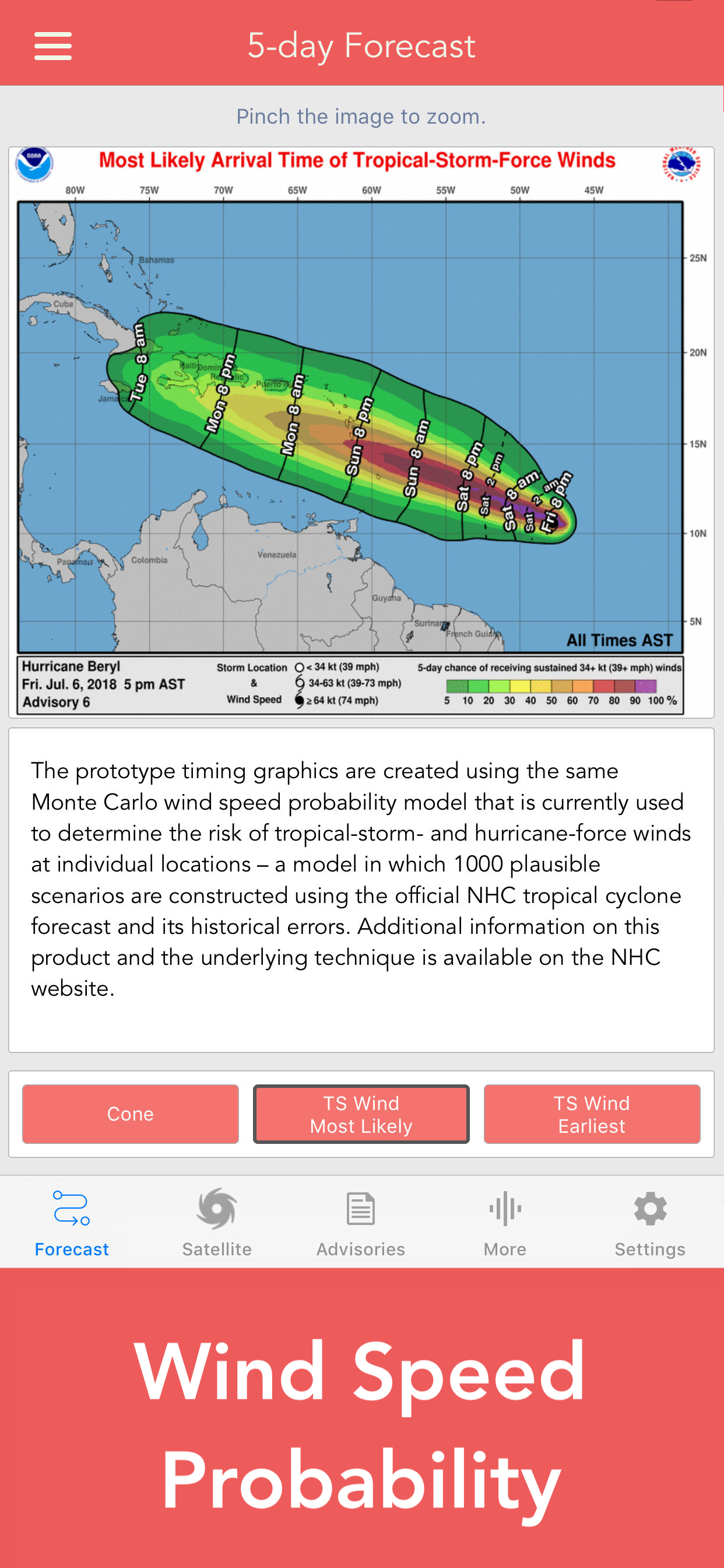
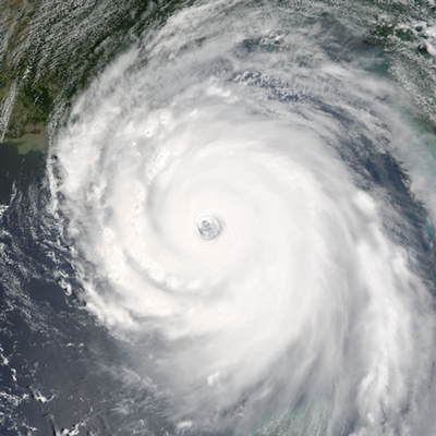
Download the most comprehensive Hurricane Tracker app for iOS. MAIN FEATURES INCLUDE: + GOES Satellite Imagery Animations + National Hurricane Center Products + National Weather Service Alerts + Weather Prediction Center Graphics + Tropical Weather Push Notifications + Satellite Imagery Home Screen Widget + Spaghetti Models GRAPHICAL PRODUCTS INCLUDE: Forecast Graphics - Spaghetti Models - 5-Day Tropical Weather Outlook - 2-Week Global Tropics Hazards Outlook - 3-Day Excessive Rainfall Outlook - 7-Day Quantitative Precipitation Forecast Storm Specific Graphics - Key Messages - Cone Track Forecast - Tropical Storm Wind (Most Likely) - Tropical Storm Wind (Earliest) - Hurricane Wind Probability - Surface Wind Field - Surface Wind Analysis - Wind / Track History - Rainfall Forecast - Flash Flood Risk Local Storm Threat Graphics - Flooding Rain Threat - Wind Threat - Surge Threat - Tornado Threat - Rainfall Totals - Wind Warnings Note: Local threat graphics are typically not available until shortly before storm landfall. TEXT PRODUCTS INCLUDE: - Tropical Weather Outlook - Forecast Advisories - Public Advisories - Forecast Office Discussion - Local Statement (HLS) - Local Warnings (TCV) - Tropical Discussion - Wind Analysis WEATHER MAP OVERLAYS INCLUDE: - Hurricane Track & Intensity - Potential Storm Surge Flooding - NASA Sea Surface Temperature - NOAA Weather Radar GOES SATELLITE IMAGERY INCLUDES: Fifteen (15) Satellite Imagery Filters - Visible (Band 2) - Near IR (Bands 4 & 5) - Infrared (Bands 7, 8, 9, 10, 13, 14 & 16) - Nighttime Microphysics - Day Cloud Phase - True Color - Air Mass - Sandwich -- PRO SUBSCRIPTION FEATURES -- More than sixty (60+) new hurricane tracking products were added for the 2020 Hurricane Season. These features include: Full Screen, High Resolution Satellite Imagery: - Latest Image - Animated Loop - Geostationary Lightning Mapper (GLM) - Mesoscale: Near Real-time Imagery Mesoscale imagery typically has 1-minute temporal resolution, but is not always available for each storm. 16-day Weather Forecast Models: - Global Forecast System (GFS) - Global Ensemble Forecast System (GEFS) - North American Ensemble (NAEFS) Weather Simulation Forecast Models: - Hi-Res Rapid Refresh (HRRR) - Hi-Res Ensemble Forecast (HREF) - North American Mesoscale (NAM) - Hi-Res North American Mesoscale (NAM-HIRES) - High Resolution Window (HRW-FV3, HRW-ARW, HRW-ARW2) - WaveWatch III (WW3) - European Centre for Medium-Range Weather (ECMWF) HMON & HWRF Hurricane Forecast Models Experimental Forecast Animations: - Simulated Radar 2km - Surface Pressure, Wind - 200mb Temp, Ht, Wind - 700mb RH, Ht, Wind - 850mb Vort, Wind, Thick Model Analysis & Guidance Animations: - 6h Total Precipitation - 10m Wind - 200mb Vort, Wind, Ht - 500mb Relative Humidity - 500mb Vort, Wind, Ht - 700mb Vort, Wind, Ht - 850mb Vort, Wind, Ht - 850mb 500 Ht, 200mb Wind Static Forecast Products - Track* - Intensity* - Pressure* - Rain - Wind * Track, Intensity and Pressure graphics include spaghetti plots when available. Models included in spaghetti graphics include: HWRF, HMON, CTCX, AVNO, SHF5 & OFCL. NCEP / EMC Cyclogenesis Tracking Products - 10-day Probability of Formation - 16-day Storm Forecast Tracks CIMSS Tropical Cyclone Products - Wind Vorticity & Shear Analysis - Steering Layer Analysis - Morphed Integrated Microwave Imagery - Advanced Dvorak Technique (ADTV9.0) ADT Includes imagery, wind radii estimates & trends Interactive Hurricane Tracker Map - Track & Intensity Forecast - Preliminary Best Track Analysis TERMS & CONDITIONS https://lwbrandsllc.com/hurricane-app-terms-conditions/ -- In total, there are now over 100+ hurricane / weather tracking products to help you stay informed during hurricane season.